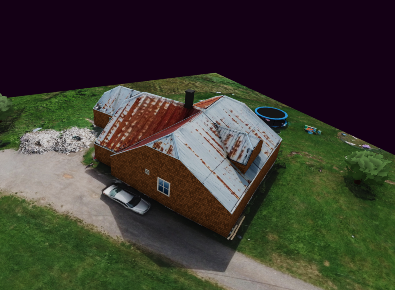
Upload one drone flight and Powerlily reconstructs the property as a current orthophoto and a measured 3D surface. Apply both to the same project, lay out the final system, and carry that site truth into the proposal and permit workflow.
Included with Powerlily Pro · GPS-tagged photos or DJI video + SRT
Remote imagery is excellent for the first conversation. A drone survey brings the post-sale design back to what is on the roof today, without moving the work into another platform.
Capture new roofs, additions, trees and obstructions as they exist now—not when an imagery provider last flew the area.
Use centimetre-scale imagery and elevation to resolve roof planes, ridges, pitch and site geometry.
Apply the survey inside the existing project and keep design, production, proposal and permit work together.
The field team captures the property. Powerlily handles the reconstruction and returns it to the designer in the project they already use.
The orthophoto is not a screenshot from the flight. Hundreds of overlapping views are aligned into one top-down image. The surface model carries the height beneath it, so the picture and the roof geometry stay registered while you design.
Start the estimate with Google, Nearmap or another available remote source. After the site visit, apply the drone reconstruction to the same Powerlily project for final layout and documentation. Sales and operations do not have to redraw the job in separate design systems.
Remote and drone-based design are not competing workflows in Powerlily. They are two levels of site certainty inside the same project.
| Feature | Drone site survey | Remote imagery |
|---|---|---|
| Best stage | Final design and verification | Early estimate and sales |
| Capture date | Your site-visit date | Imagery-provider date |
| Image source | Your own ~2 cm orthophoto | Google, Nearmap and other providers |
| Elevation source | Your own ~3 cm surface | Available DSM or LiDAR coverage |
| Works inside Powerlily Design | ||
| Flows into proposals and plan sets |
Approximate output resolution depends on flight altitude, camera quality, motion blur, overlap and scene conditions. Absolute placement remains limited by the drone's GPS accuracy.
Powerlily accepts original GPS-tagged photos from a camera drone. DJI operators can also upload a video with the matching external SRT telemetry file, and Powerlily extracts and prepares the usable frames automatically.