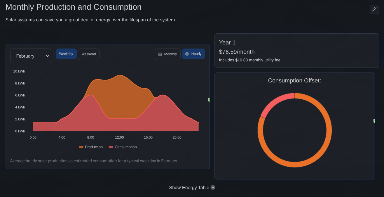
A year of production. Per panel. Live as you design.
8,760 hours of irradiance simulated for every module using the Perez sky model, refreshing as you draw. No 'Calculate' step. No coffee break.
Built for the way solar actually gets designed.
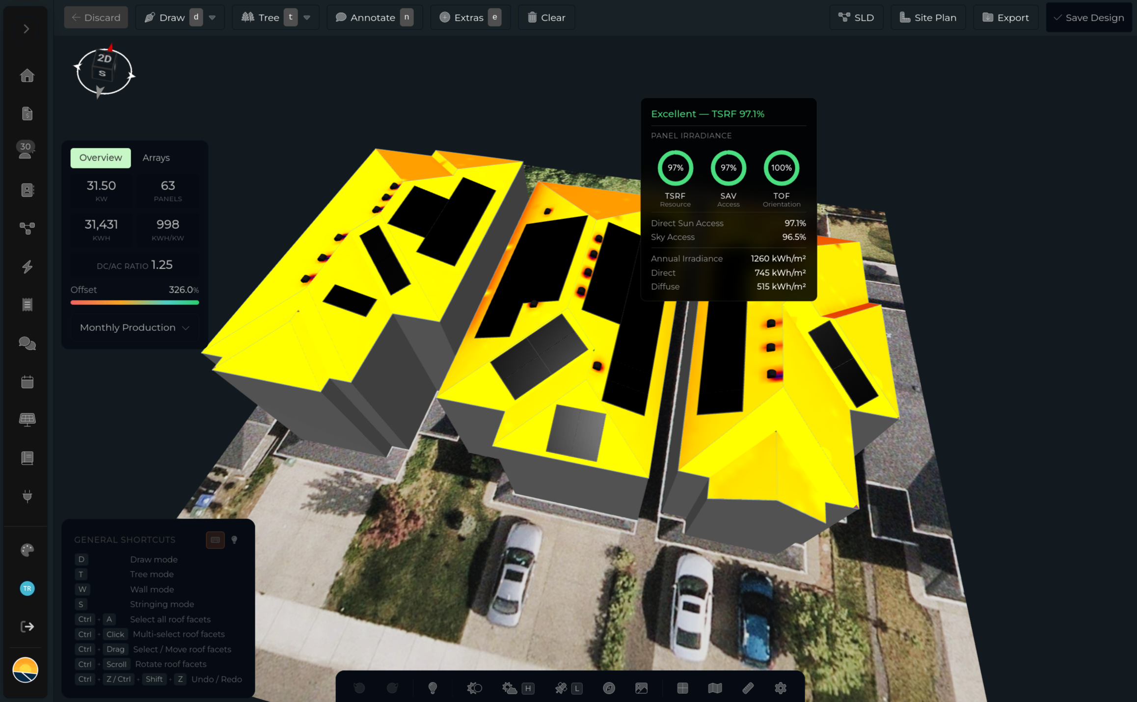
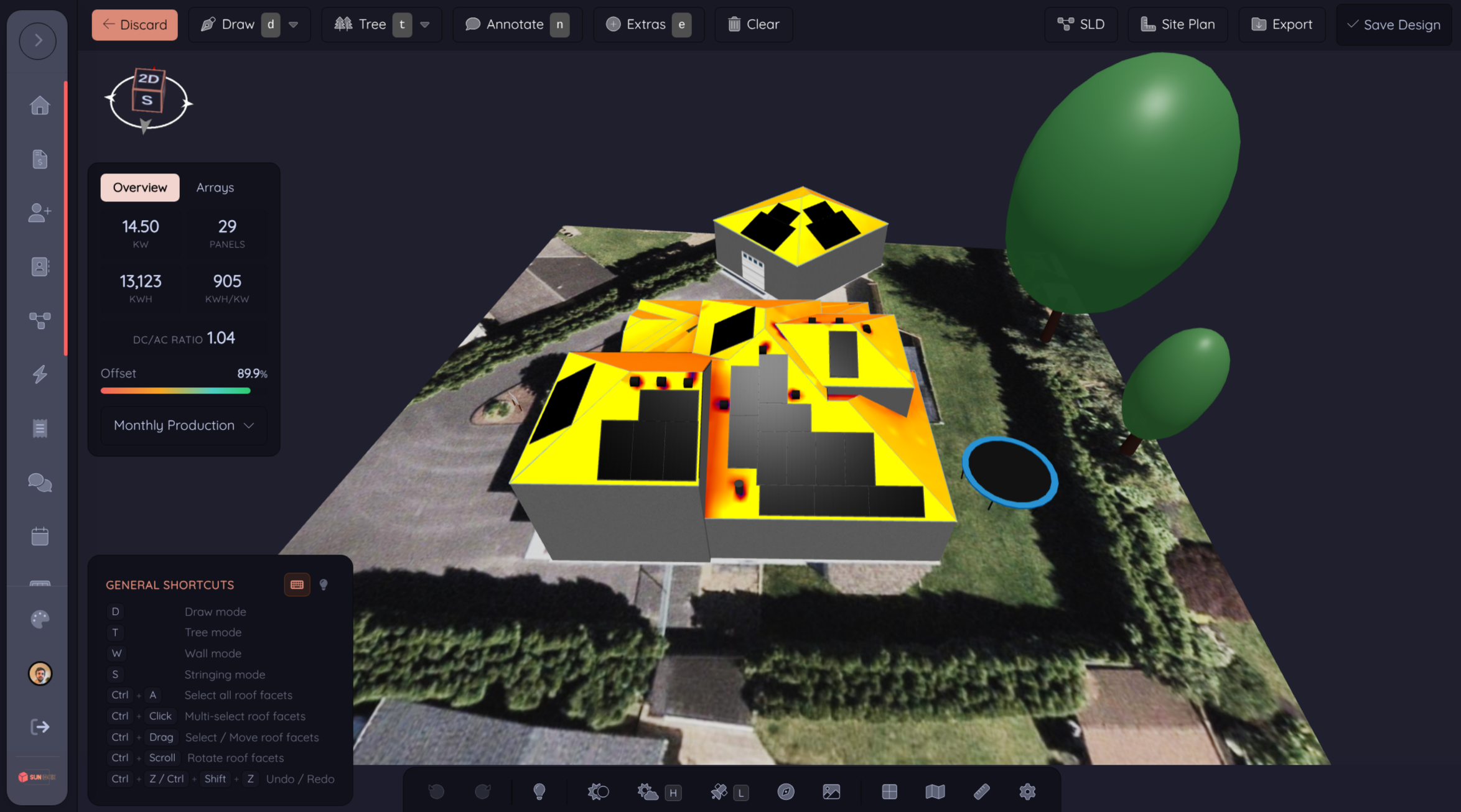
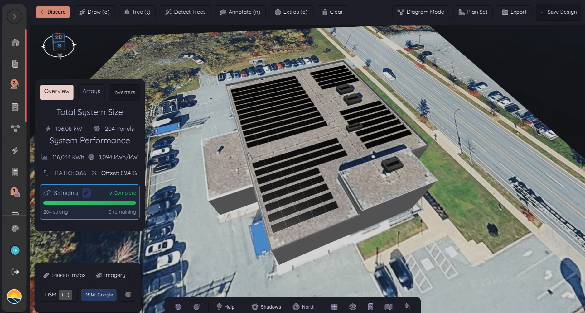
Every install type, every workflow, every measurement, all in one tool that doesn't make you wait between actions. Design residential or commercial in the same canvas. SAV, TSRF, TOF, and per-panel hourly production all calculated live as you work.
- Every install type, residential, commercial, ground mount, carport, single & dual-axis trackers
- Smart draw with snap-to-edge and auto-fill panel placement
- 2D and 3D in one canvas, no separate views to manage
- Trees, obstructions, annotations, all on the same model
- SAV, TSRF, TOF + per-panel hourly production, calculated live
- Real DSM elevation drives tilt, azimuth, and height automatically
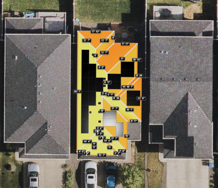
Automatic roof plane detection.
Smart detection identifies planes, ridgelines, and obstructions automatically using Digital Surface Modeling. Speed up your design workflow without sacrificing accuracy.
- One-click roof detection
- Pitch, height & azimuth from real DSM elevation
- Obstruction identification (vents, chimneys, trees)
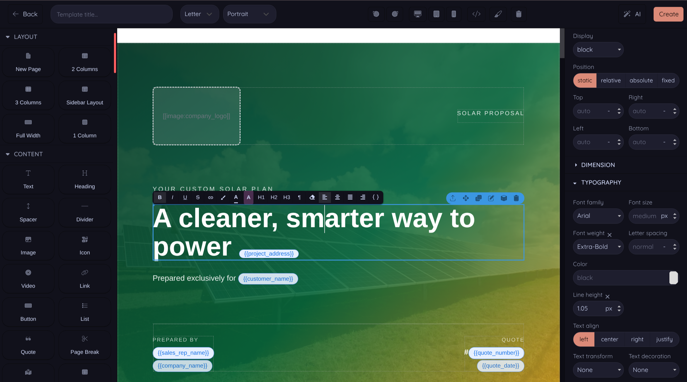
Design a website around your proposal.
Three ways to send proposals: tested pre-built templates that convert out of the box, instant web proposal pages with no design required, or a beautiful drag-and-drop editor when you want pixel control. Pick the path that fits the deal.
- Tested pre-built templates that convert, use them out of the box
- Instant web proposals, no template design required
- Drag-and-drop visual editor for full pixel control
- Custom CSS per template, full control, no developer required
- AI content generation per section
- Mobile, tablet & desktop preview, liquid variables, custom domain
- 3D scenes embedded directly in your PDFs
Your brand, front and center.
Interactive web proposals AND branded PDFs from the same template. Know when customers open them, know when they sign.
- Interactive web proposals (custom domain supported)
- Branded PDF exports
- Proposal open & engagement tracking
- Digital signature integration
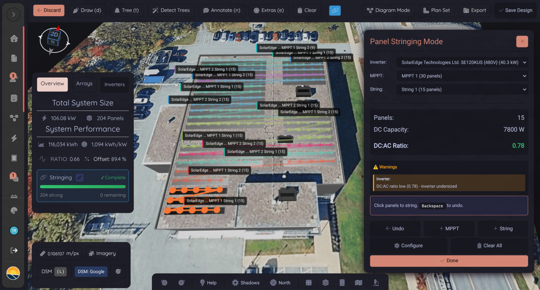
Intelligent string configuration.
Automatically generate optimal string configurations based on your inverter specs. One click, done. Override manually whenever you need to.
- Automatic string sizing based on inverter MPPT range
- Inverter-aware optimization (string, micro, hybrid)
- Manual override when you need finer control
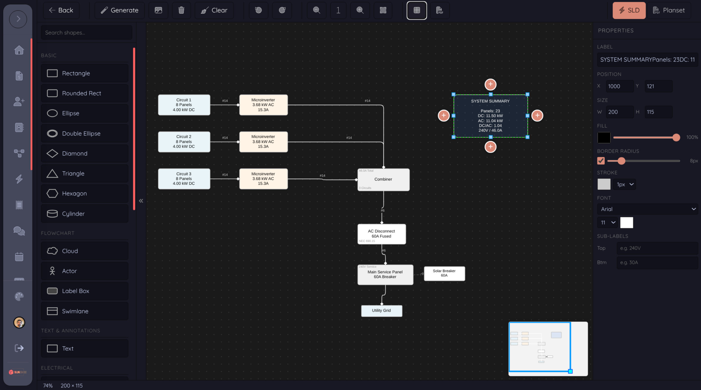
A real SLD editor. Not a locked template.
Other tools auto-generate a single line diagram you can't change. Powerlily gives you a full WYSIWYG canvas, draw, upload images, position every component, and own the output. Start from a baseline or upload your own diagram and build on top.
- Multi-page editable canvas, draw exactly what your AHJ wants
- Upload base diagrams or component images and edit on top
- Drawing toolbar: select, draw, upload, delete, clear, undo/redo, zoom, snap-to-grid
- Built-in symbol placement for arrays, inverters, combiners, batteries
- Branded export, your logo, your title block
- PDF export when you're ready
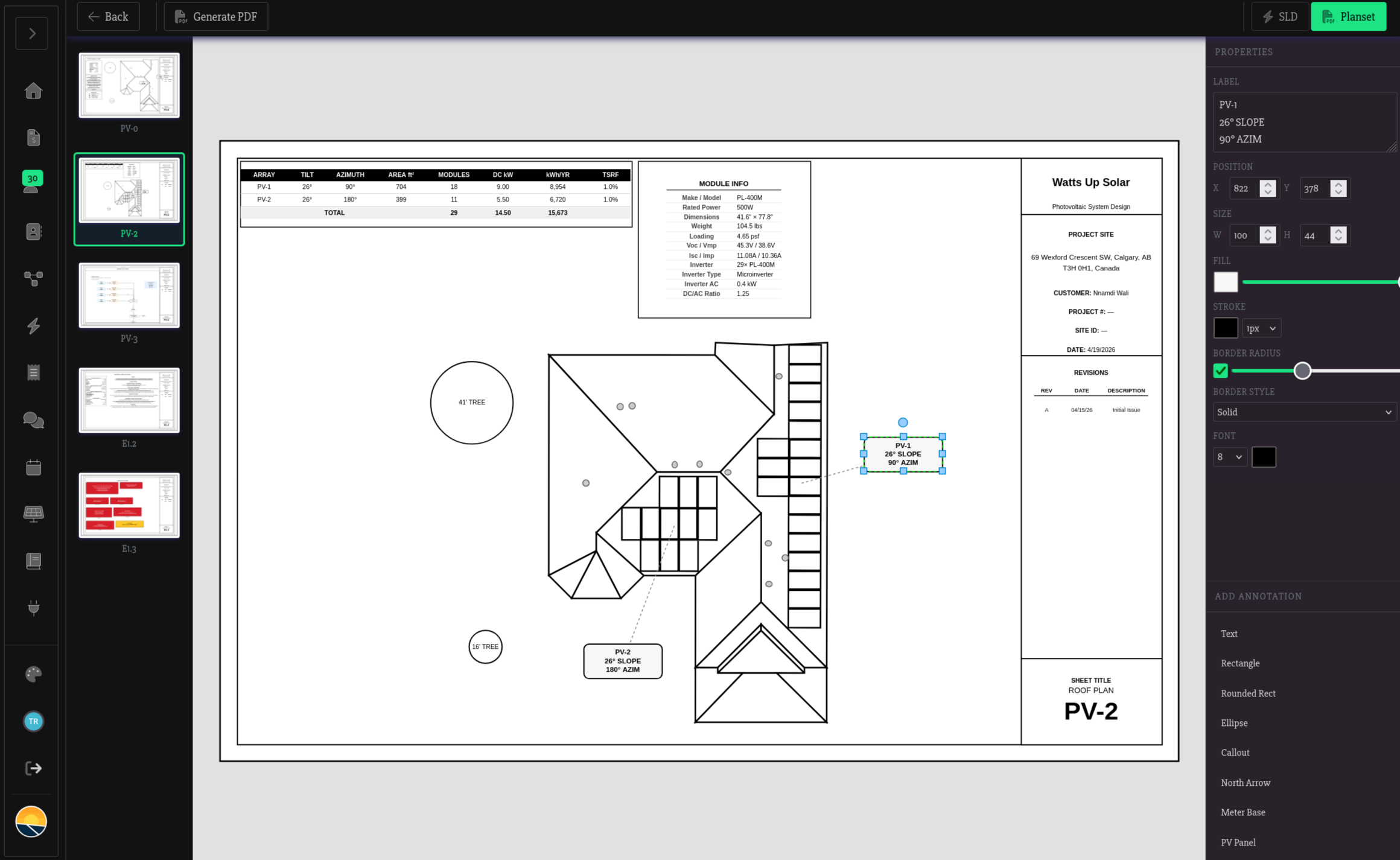
Assemble the whole permit package, your way.
A four-tab wizard puts the entire plan set under your control: pick which sheets to include, fill in project info, log revisions, and append the spec sheets you need. One click to a single permit-ready PDF.
- Sheets tab, toggle which diagrams ship in the package
- Project tab, company, customer, address, project number, site ID, prepared by
- Revisions tab, append-only revision log printed in the title block
- Spec sheets tab, attach panel, inverter, battery, and equipment datasheets automatically
- Branded output, your title block, your company info, your file name
- Single-PDF export combining diagrams + spec sheets + revisions
The reports you don't want to draw by hand.
Some things should be hand-drawn. Some shouldn't. Shade reports and racking bills of materials calculate themselves from your design, branded, live, ready to attach.
- Branded shade reports with live per-panel SAV, TSRF, and TOF, calculated as you design
- Racking bill of materials with rail lengths, anchor spacing, and waste-factor optimization
- Production report PDF with hourly projections, weather data, and array specs (for utility net-metering applications)
- Per-customer branding on every PDF
- Export from the design tool with one click
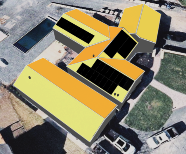
Built for commercial projects.
Full support for flat roofs, parapets, and ground mounts with customizable layouts. Real fire setbacks, real wind loads, real production.
- Flat roof & parapet support
- Configurable row & column spacing
- Adjustable tilt angles per array
- Fire setback compliance
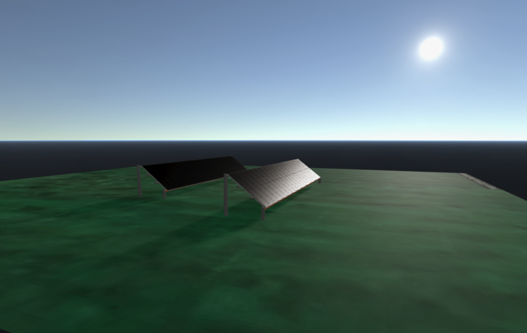
Ground mount design made easy.
Design ground-mounted solar arrays with ease. Real-time self-shading at the row level. Trackers supported.
- Intuitive canopy system
- Real-time self-shading for optimal GCR & row spacing
- Single and dual axis tracker support
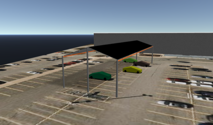
Solar carports & covered parking.
Combine parking shade with clean energy generation. Perfect for commercial lots, schools, and municipalities.
- Flexible canopy configurations
- Custom tilt and orientation
- Integrated with site design
- EV charging ready layouts
 Nearmap + DSM
Precise Measurements, Premium Imagery
Design with confidence using high-definition aerial imagery. From free satellite maps to premium oblique imagery with Digital Surface Models for accurate height validation.
- Google & Bing Maps included free
- Google HD premium imagery
- EagleView Pictometry integration
- Nearmap HD + True Ortho imagery
- Digital Surface Model (DSM) for 3D accuracy
- Upload your own drone imagery
Built for accuracy and speed.
simulated per panel, every year
lifetime production curves
of imagery + DSM data
recalculation, no calculate step