Everything you need. Nothing you have to bolt on.
Six pillars, one platform, designed to work together because they were built together. Unlimited users, unlimited quotes, one price.
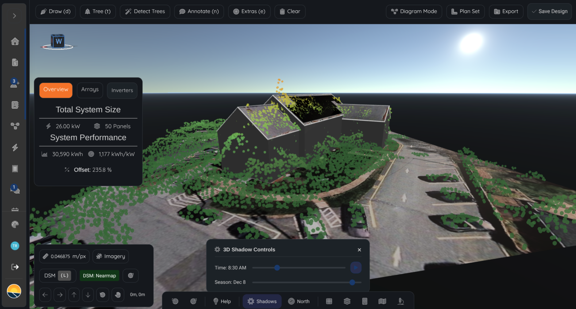
Design
3D + per-panel hourly Perez irradiance simulation, refreshed live as you draw. Real DSM elevation, real shading, real production. No 'Calculate' step.
- Per-panel hourly production for every design (8,760 hrs/yr)
- 30-year lifetime curves with degradation
- NEM 3.0, TOU export rates, tiered consumption
- 2D ↔ 3D hybrid workflow with auto roof plane detection
- Auto stringing, fire setbacks, ground mount, carport, commercial
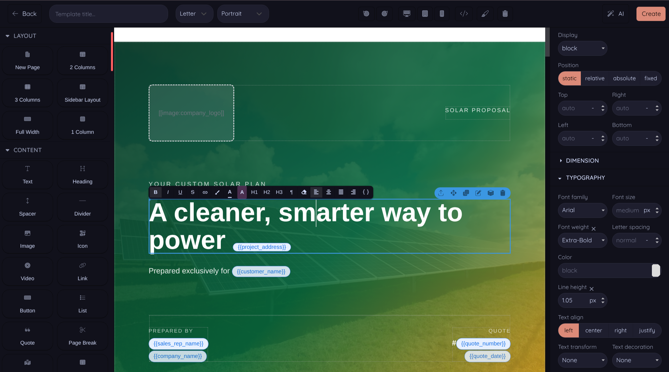
Proposals
Three ways to send proposals: tested pre-built templates that convert, instant web proposal pages with no design needed, or a drag-and-drop editor when you want pixel control.
- Tested pre-built templates that convert, use them out of the box
- Instant web proposal pages, no template design required
- Drag-and-drop visual editor for full pixel control
- Custom CSS per template, AI content generation per section
- Mobile, tablet & desktop preview
- Liquid variables auto-fill price, production, payback
- 3D design scenes embedded in PDFs
- Custom domain, open & engagement tracking
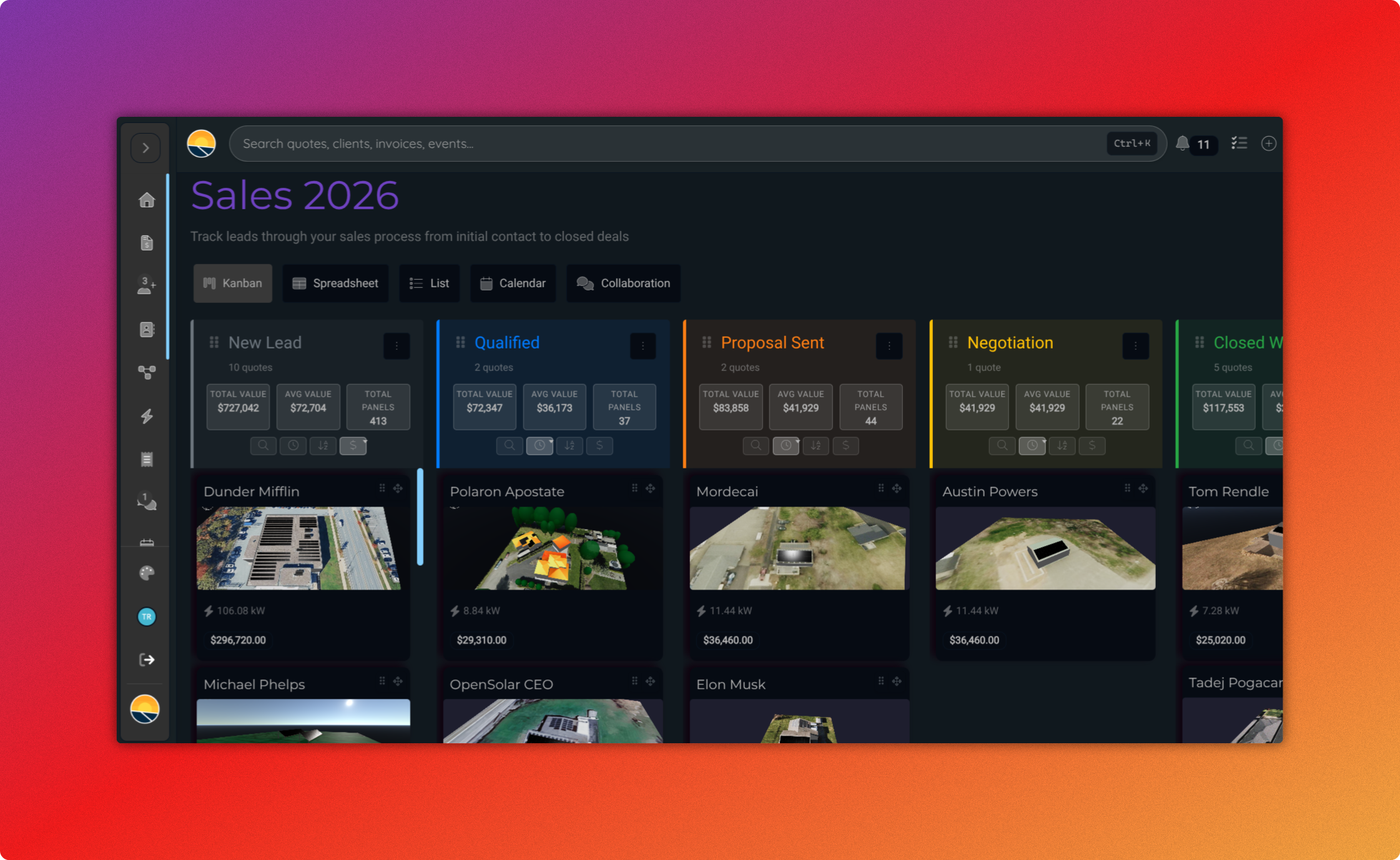
CRM & Workflow
Pipelines, leads, events, messaging, bulk operations, built in. Unlimited users with role-based access.
- Configurable pipeline stages per workflow
- Embeddable iframe lead form for your website (branded, configurable fields)
- Role-based access: Admin, Agent, Installer, Client, installers never see pricing
- Per-workflow role assignment for fine-grained control
- Shared team calendar with multi-day events
- In-app team and customer messaging
- Bulk stage moves, reassignment, tagging, CSV export
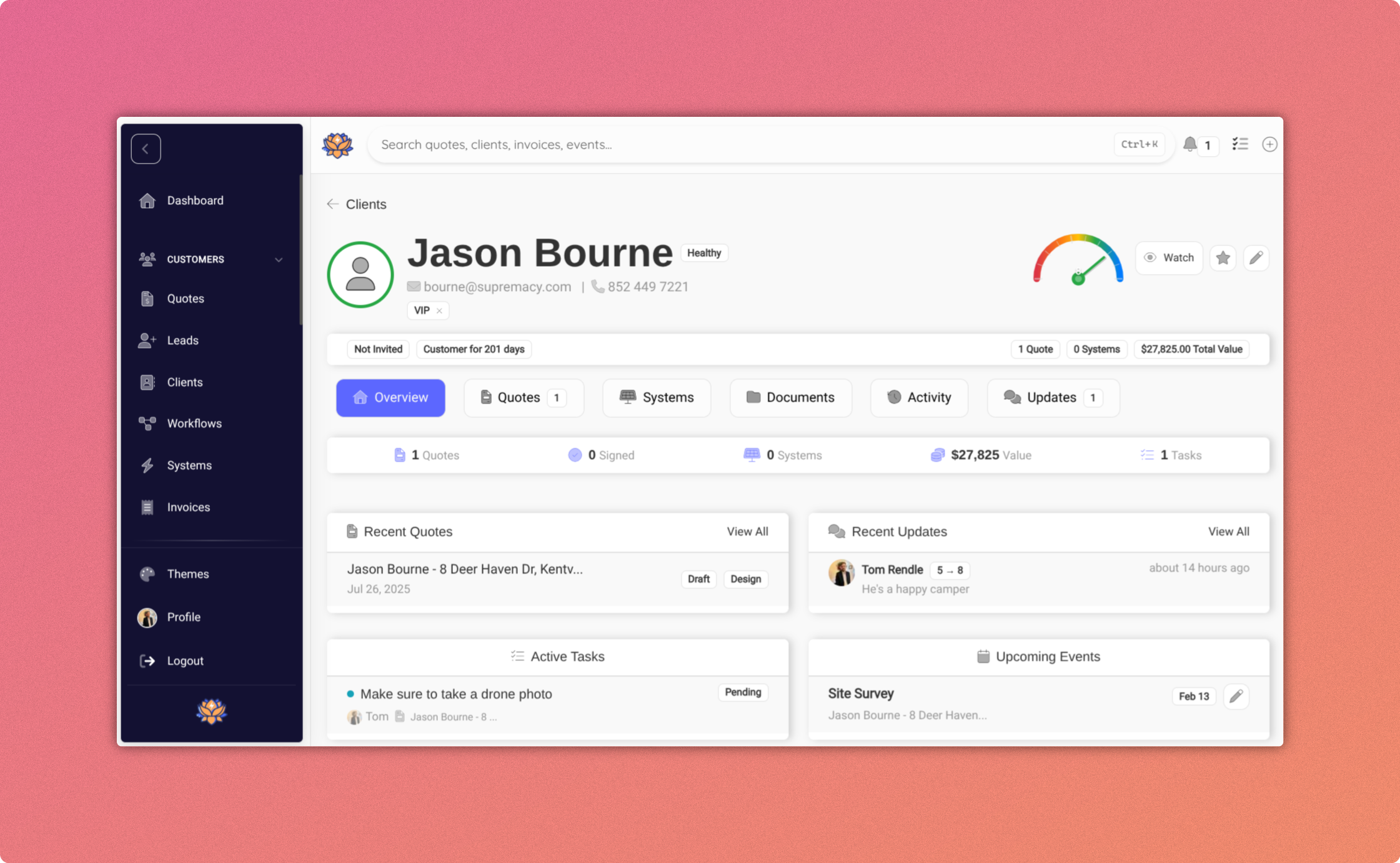
Client Portal
Branded customer-facing portals, your logo, your colors, your domain. Real-time production, project progress, document access, two-way messaging.
- Real-time production data (kWh or dollars saved)
- Project progress tracking
- Document & report access
- Two-way messaging with your team
- Per-customer referral links
- White-label everything, never our brand
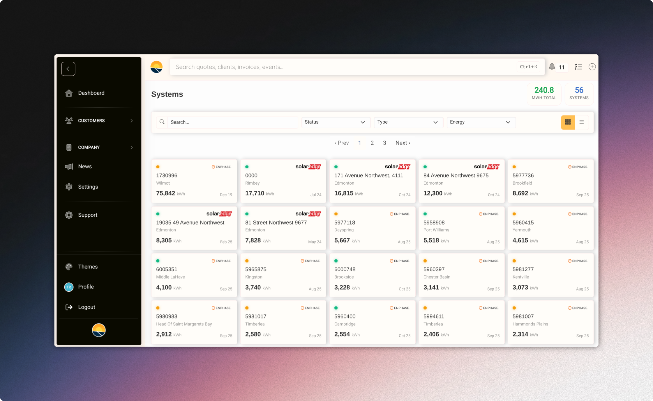
Fleet Management
Real Enphase, SolarEdge, and APsystems APIs with your own keys. No scraping, no markups. Fleet-wide alerts, branded portals, monthly reports.
- Bring your own API keys, no markup pricing
- Real-time alerts for underperforming systems
- Branded customer portals with referral links
- Automated monthly performance reports
- Public system map + leaderboard, opt-in marketing from your fleet data
- Aggregated environmental impact stats (gallons of gas, cars, coal, homes)
- Fleet-wide map view for at-a-glance triage
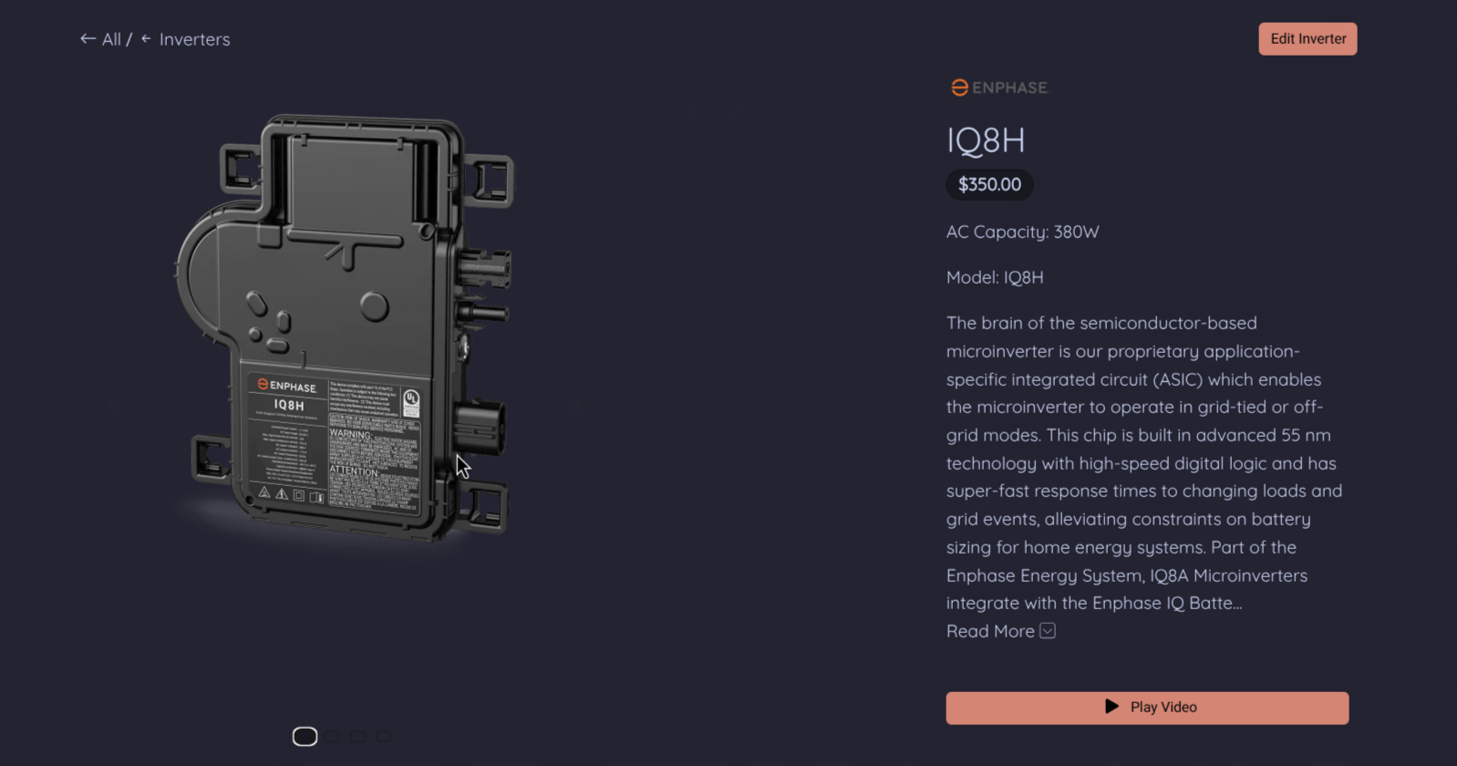
Invoicing & Equipment Library
Invoicing built in. Equipment library with 13 categories, panels, inverters, batteries, racks, optimizers, EV chargers. AI spec sheet extraction included.
- Invoice creation, PDF generation, payment tracking
- Date-range filtering, CSV export
- Equipment library: panels, inverters, batteries, 13 accessory categories
- AI spec sheet extraction from datasheets
- Brand and pricing controls per equipment
All-in-one. No add-ons.
What we include in every plan, vs what other solar SaaS tools tend to charge separately for.
| Feature | Powerlily | Other tools |
|---|---|---|
| Per-seat pricing | $0 | Per user |
| Per-quote metering | $0 | Often metered |
| Per-system fleet monitoring fees | $0 | Per install + monthly |
| LIDAR + DSM elevation on every plan | Locked to higher tier | |
| Multiple imagery providers included | 5+ | Add-on for higher-res |
| Per-panel hourly Perez simulation, live | Manual 'Calculate' step | |
| 30-year lifetime curves with NEM 3.0 / TOU | Limited | |
| Visual proposal template builder | Limited template editing | |
| Pre-built proposal templates that convert | ||
| Instant web proposal pages (no template needed) | ||
| AI content generation in proposals | Limited / add-on | |
| Custom domain for proposals | ||
| 3D scenes embedded in PDF | ||
| CRM with configurable pipelines | Separate product | |
| Embeddable iframe lead form | Limited | |
| Role-based access (Admin / Agent / Installer) | Per-seat tier | |
| Branded client portal | ||
| Fleet management with real inverter APIs | Add-on / separate vendor | |
| Public system map + leaderboard | ||
| Built-in invoicing | ||
| Equipment library + AI spec extraction | ||
| Unlimited users, no per-seat fees | Per-seat pricing | |
| Unlimited quotes | Often metered |
Based on publicly available pricing across common solar SaaS tools. If we got something wrong, let us know.
all in one place
per-seat fees, ever
simulated per panel, every year
for your whole team